my blog

Goat Lake

www.wta.org/go-hiking/hikes/goat-lake

This hike has great bang for the buck. In summary, it is a moderate 10 mile hike (roundtrip). There are two paths, the lower along a roaring creek, the upper along an old logging road with waterfalls here and there. There is a big series of cataracts known as the Mackintosh falls about 10 minutes before the lake. The lake itself is big, clear, calm and surrounded by mountains, a typical alpine lake. This hike is well worth doing.

The trailhead is about two, two and a half hours away from the Eastside. It involves a dreary drive through I-5 till Everett but the scenery picks up a half-hour or so after crossing Everett and starting off on the Mountain Loop Highway. The Mountain Loop Highway is a very nice drive from Granite Falls along the Stillguamish river. Right now, there are flowers in bloom so the road is flanked by blue flowers and is delightful.

Mountain Loop Highway


———–


At the trailhead


—-

From the trailhead, there are two paths to the lake. I would recommend taking the lower, harder, more scenic route on the way up to the lake and the upper, longer, straighter route on the way back. The sounds of the Elliot creek never leave you as you walk up the lower trail. The forest is a beautiful green!

Water


Water


Everywhere

——


The trail is in great shape and every now and then there are markers of where people have helped make this lake accessible.


—–


At about 3.5 miles the upper and the lower trails meet and form one path that heads to the lake. The trail enters an Alder forest (TIL) and this segment of the hike is strikingly different and incredibly pleasant.


Ambling through Alder

—-


On a lonely road …

—-


There are plenty of nice flowers on this trek:

  • Yellow flowers with five petals
  • White flowers with five petals and a line dividing each petal into two. My hypothesis is that these are baby flowers and they grow up to become violet flowers with a line dividing each petal into two
  • White flowers with three big petals
  • Juicy Shrimps: a tall stalk and then a shrimp like flower

The only competent picture of Wildflowers

—-


Assorted Fungi


There are also several places where creeks have invaded the trail and involve some walking through mud, delicate footwork and an occasional soak of the socks.


Elegant footwork!


Four miles into the hike is the first serious elevation gain alongside a stream. This is an ideal place to stop, take a breath and then look at the Cascades. There are quite a few peaks peeking out periodically through the foliage.


There is no better picture of this peak K

—–


Peeking Peak 2

—-


Peeking Peak 3


A little way after this is Macintosh falls which is worth the side detour.


Macintosh falls


The lake is just a short way away from the falls. There are tall peaks on all sides and the lake sits nestled amongst them, carved out of old Glaciers. It’s a big lake, very quiet, filled with clear, delicious cold water.


Goat Lake 1


Goat Lake 2


On the way back, I recommend the Upper Elliot trail which is along an old logging road. It is a simpler walk, punctuated by many creeks and waterfalls. It does get a little monotonous towards the end though.


Just another pretty cataract.

—-


Overall, Goat Lake is a moderate hike with a nice creek, some pretty waterfalls, greenery and a most excellent lake at the end.

Bridal Veil Falls

You look radiant on a gradient! –CeG <obelIX>

www.wta.org/go-hiking/hikes/bridal-veil-falls

This is my third visit to these waterfalls. They are an hour’s drive away and provide a decent hike with a nice spot to have lunch at. We left at 9:30 in the morning and were at the trailhead at 10:30-10:45. The hike took about four hours, we went up to the bridge on the Lake Serene trail, then up to the waterfalls where we had lunch and headed back down. I messed up while using the app so I don’t have detailed metrics today K.

The hike begins on an old road for the first three tenths of a mile. There’s a little forest cover but it’s not young and green and watery, it’s somber and a little less full of life. Mount Index (aka Mount Aprameya Rao) shows its peaks through gaps in the trees.


The start of the trail

—–


It’s not a slightly less-life-filled green at the beginning

—-


This trail is punctuated with many streams and creeks and waterfalls. There are bridges over the big ones, logs over the medium ones and opportunities to test the goretex on your shoes as you splash through the small ones.


I’ll just go around the rock then …

—–


A small stream, three quarters of a mile into the trail

—-


About one and a half mile into the trail the road forks (it forks a couple of times before but they are all well marked) and there is a short climb up to the Bridal Veil falls view point while the main trail continues on for another two miles on to Lake Serene. I recommend following the main trail for another quarter of a mile, crossing the bridge over the Bridal Veil creek and looking at another unnamed water falls on a sheet rock. Turn back from there and then visit the Bridal Veil falls view point and then head back for an approximately 5 mile hike. The trail at this point is greener and livelier.


Mossytrunk

—-


Assorted Fungi

—-


There are many zenlike waterfalls on the trail. From my sources on the hike, the water is delicious, cold and sweet.


Zenlike Waterfalls

—-


The bridge across Bridal Veil creek

—-


Walkaway


Sheet water falls


The last half mile to the falls is where all the elevation is. There is a set of staircases and then a walk along the side of a mountain. This is a good time to take breaks and look around, on a clear day there are lots of peaks visible.


Unnamed Peak 1

—-


Unnamed Peak 2


Mount Index

—-


The staircases/boardwalks on this trail are amazing


We reached the falls at sometime around 1 when the sun was high in the sky and made good photographs impossible. Last year, it had been overcast but I can’t find that post so no pictures of the falls themselves. We ate a very nice lunch (Subway) at the Middle Falls and headed back.


Lunchtime

—-


Wallace Falls

http://www.wta.org/go-hiking/hikes/wallace-falls

Waterfalls are formed when rivers get lazy. –CeG<oBelIX>


The first hike of the season upto the Middle Falls in Wallace Falls State Park (WFSP). WFSP is close by, a little under an hour away if you keep at the speed limit and there isn’t much more you can do given the traffic on 522 and US 2. I’d have thought by now the construction would be done but they are still at it.

Before I ramble on or start talking about the hike, allow me to introduce, the wife who blogs at http://wondrousdaze.blogspot.com. The two of us went up to Wallace Falls last Sunday (which was the first Sunday in April 2014).

The start of the hike, a quarter mile under some humming power lines is not an indication of the rest of the hike. The hike starts at a viewpoint where on a clear day, Mt. Index (once renamed as Mt Aprameya Rao) should be visible. We could only see a hint of the cascades.


The viewpoint

The trail starts off under the canopy of nice forests with the sound of a river in the distance. The river, named Wallace, after the state park I am sure, was nice and cool and blue-white. It has a pleasant, soothing sound which is a good companion to have on a hike.


There are interesting signs, I like this idea a lot

—-


The start of the trail


The white Wallace river

——


The trail goes past a sign for the Small Falls which is a short detour off the main trail. I highly recommend this, it gives a good taste of what is to come and if you have the impatient types in your group (this means little kids who ask lots of questions [based on my limited knowledge of little kids]).


The small falls

—–

The trail then turns away from the river and climbs at a gentle pace. It’s not grueling except for a couple of places or so (there is an elevation chart at the bottom of this post). It eventually comes back to the river and eventually you hit a viewpoint where the North Fork of the Wallace river joins the main river. The North Fork comes from Wallace Lake which when can be added to this trail and forms a nice loop. We headed back from the middle falls itself. It’s at this point you get an idea of how much you have climbed.


The confluence

—-


Getting High.

On a clear day the Olympics are visible on the horizon

—–

The trail crosses the North Fork on a wooden bridge that is very pleasing to the eye. The water has a nice gurgle and its rate of flow adds a little oomph the environment.


The bridge across the North Fork of the Wallace River

—-

Climbing further, a booming sound adds to the gentle notes of the river. It took me a moment to realize that it was the sound of the waterfall. The first view point is very mediocre but has a small trail to let you see the pool below the falls. It’s the next viewpoint, perhaps half a mile further up the trail that provides the magnificent view. The waterfall is tall and had a lot of water and well, I’ll let the picture do the rest of the talking.


Wallace Falls from the Middle Falls viewpoint

—-

The hike back down was fun with lunch on a bench (a great feature of this trail, there are many benches allowing for moments of quiet contemplation). We photographed some fungi and were back in 2 hours 27 minutes (I used an app called RunTheMap which was pretty cool to record stats about the hike).

Total Distance: 4.12 miles

Total Time: 2:27:10

Elevation Gain: 892 feet

The route

Elevation Profile

Getting High Sweetly

Alternately titled: weed jamuns, pot jamuns, how to infuse marijuana in Indian desserts

I had a much cooler name for my last experiment where I combined different flavours and chemicals that I liked. The result, vodka and coffee, also known as Vodka+- (Copyright pending) was received with mixed reviews by the test audience (myself).

Along similar lines and after having discovered that I could actually make Gulab Jamuns that are good (they have not caused any known casualties) I decided to add a little something-something, a little oomph, a little afterburner, a little more kick to this sweet Indian delicacy. The rest of this post talks about the first ever attempt at combining an Indian sweet (a very delicious Indian sweet – one of my favourites) with a chemical that causes some very pleasant effects. This post is slightly more scientific than my previous post (though nowhere approaching the rigour that I would have liked) and used a brave and hungry classmate as the test subject.

I do not really know when I first got this idea and the experiment happened at oBelIX pace. The theory behind the idea is fairly sound. The active ingredient in weed is THC, a chemical that is poorly soluble in water but has high solubility in fat, oil. Wikipedia states:

THC has a very low solubility in water, but good solubility in most organic solvents, specifically lipids and alcohols

Based on this, and given that ghee, the binding agent for the batter that makes the jamuns is a fat, it should be possible to infuse weed in Gulab Jamuns (infact, by extension it should be possible to make weed-egg-fry and so on).


Getting Started

You will need:

  • Everything you need to make Gulab Jamuns
  • Weed

[Note: This post assumes some familiarity with how to make Gulab Jamuns]


How Long does it take to make: A couple of hours


How do I make it:

  1. Infuse a little ghee with THC
  2. Make the balls
  3. Make the syrup
  4. Fry the balls
  5. Put the balls in the syrup

For steps b, c, d, e please use a search engine of your choice or alternately this link.


Step A: Infuse a little Ghee with THC

The key step and deciding factor in your experience is how much THC you get in your ghee. The quantities below are enough to make about 10 Gulab Jamuns and get one person sweetly high. YMMV.


Finely grind the plant material

This is a rather important step. The finer you grind, the more surface area that is exposed and the more oomph that your jamuns will pack.

—-


Melt the ghee in a pan

When melting the ghee, make sure to use the quantities that make sense for the amount of Jamuns you are going to make. The solubility of THC should not be a concern


Add the plant material to the ghee

This is where the THC is going out of the plant and into the oil


Stir for about 40 minutes


Wait and stir. It is important to use very low heat – the aim is to not set the house on fire or burn the plant material but to extract, slowly, gently. Patience is a virtue. So is soothing music. It is working well when the apartment has a certain smell to it.


Drain


Once done, the ghee should be less clear and more brown. It will also taste slightly off.


Once you have this infused ghee, proceed to make the batter as usual and everything else stays the same. Important things to note:

  • The raw balls have a slightly incorrect taste. This gets significantly reduced as the Gulab Jamuns absorb the sugar in the final step
  • Make sure the oil you fry the balls in is warm. I did the intelligent thing of putting on the incorrect stovetop and waiting for the oil to heat up


Observations

The key one: it worked. This can be corroborated by two independent observers (one was me) and the test subject in question. He was hungry enough to have all nine of these and did exhibit classic symptoms of being high such as:

  • My head feels like there is liquid in there
  • Everything is so slow
  • Etc etc etc


The taste of the Gulab Jamuns was not perfect. There is still more refinement needed. The weed infused ghee doesn’t behave the same as normal ghee and the balls don’t hold together as much.

—-

PS1: Yes, I am a long way away from my own blog about cooking

PS2: More experiments are needed

PS3: Since THC is soluble in alcohol, pasta in the kind of sauce cooked with wine or vodka!

oBelIX in Ottawa – I

This post comes to you from a fairly comfortable, inexpensive room, ten minutes away from downtown Ottawa. I happen to be here because of a rather important need to get a visa renewed. I will not deliberate on the ridiculousness of this ridonculous requirement (yet another
example of how to improperly break up the flow of a sentence). Anyway, since I am here, for a good long time, I will chit-chat, write about Ottawa.


Part I: United and Chicago

I flew United airlines once again, not out of choice or desire, but more because this-is-the-cheapest-flight. I slept soundly through the first flight out of Seattle which left at the ungodly hour of 6AM. I woke up only twice through the entire flight, and both times it was because the dude in the seat next to me had to pee. Anyway, I landed at Chicago airport, around lunchtime, hungry and decaffienated. There was a Starbucks so I popped over and picked up one of their sandwiches. The lady, broad and of a very southern accent said, “Those are 9 dollars.” I looked down at the sandwich in my hand, it was two slices of bread with some turkey and cheese and lettuce and tomato and onion. Nine dollars, I thought to myself. I got the coffee and mosey-ed over to “Johnny Rockets” fast food where I promptly got a far more affordable and value for money meal.


Part 2: The US Embassy in Ottawa or Applying for a US visa in Ottawa

This part is actually useful information so readers looking for bc/timepass should skip this section. Anyway, the important things to keep in mind for the US Embassy in Ottawa are:

  • Do not carry any bags with you – they will not let you in past the first door
  • Do not arrive more than half an hour before your appointment – they will not let you in
  • Ensure that the photograph is current – people were sent away for this
  • No cell phones
  • Be prepared to wait a long time
  • There is no food inside

Just to make sure that this is not a totally useful section, I will add this rather interesting piece of trivia that the consular officer told me: “Ottawa is the second coldest capital in the world”


Part 3: Ottawa

I like Ottawa. I like most places where walking is easy and encouraged. Ottawa seems to be such a city. It is small. It is well-defined. I understand how it is laid out. It takes about five kilometers of walking to understand a neighbourhood and by now, I’ve walked around far more than that – I count approximately sixteen kilometers. My fairly comfortable, inexpensive room is in the city of Gatineau, about a kilometer and a river away from Ottawa itself. Crossing this river puts me in Byward Market, an upscale set of restaurants, bars and shops which I shall investigate over the course of the next few weeks. Past the market the neighbourhood grows a touch less posh. There are homeless gentlemen, one of whom was very convinced I was from Russia and kept asking me for change or whether I wanted some Vodka.

I had dinner at an Ethiopian restaurant called “The horn of Africa.” It was a shabby run-down place and I walked three kilometers to get there. Upon entering, I was greeted by the glummest gent on the planet. He led me, dourly, to a table and got me a menu. I asked for the Shiro Wot which was not available. I asked for the Kik Wot. I asked for it spicy. It came, arranged rather unflatteringly on three injeras that did not really feel like they wanted to be eaten. It took me ten minutes to get through the food which I attribute to me being cold and hungry and not to the quality of the food. Tl;dr: Do not go to the horn of Africa for Ethiopian food. Tomorrow, I plan to try out one of the cheap shawarma restaurants: Shawarma King or Castle Shawarma. There is also a Café India King which sounds interesting and a pub called that offers Husband Daycare!

The weather in Ottawa is cold, hovering around 5 degrees Celsius in the day and 0 at night. The cold is tolerable, it is the wind that is a bitch. Suffice to say, my current pair of gloves will not cut it and I am very glad I got my Russian cap and overcoat along.


The parliament atop its hill

Alternately Titled: Please excuse the trees in the bottom left

—-


Sunset on the river

Alternately Titled: I should have left fifteen minutes earlier

—–


Rent-A-Bike

Alternately Titled: Stand farther back when you take a picture you idiot

—-


Ottawa At Night

Alternately Titled: You should have cropped out that tree

Day 6: Beartooth

Total Distance: 2711 miles

Part 1: Grand Teton National Park

Jackson Hole Coffee Roasters has good Egg Bagel sandwiches. –CeG <oBelIX>

Any road that says, “Scenic Drive” should always be taken. –CeG <oBelIX>

I will admit that I did not have a fixed plan when I woke up. I wanted to head generally north and generally west and so decided to drive through Yellowstone. After a quick cup of coffee and an egg bagel sandwich I headed back on the road I had driven last night, US-89 and north through Grand Teton. It was still cloudy over the mountains so I did not get to see the Tetons. I did see a turn for the Signal Mountain Scenic Drive and with nothing on the agenda I took it. It was a five mile drive up a hilly road. There were deer and these deer are very under-nourished when compared to the ones on Hurricane Ridge. I blame this to the lack of wildflowers. At the top of Signal Mountain is a view of the valley (or flood-plain or whatever-it-is-that-is-known-as-the-area-that-a-river-irrigates-or-drains). It was far too bright to get a competent photo.

Malnourished deer


That stretch of water is the Snake River

Jackson Lake and one of those insufferable Tetons

The next stop on the road up north was the lodge at Signal Mountain. There was a giftshop where I picked up assorted items and relied very deeply on the kindness of a total stranger. There were also boats and kayaks for rent but boating or kayaking on a hot day all by myself does not appeal to me. I headed further North, crossing a dam and more views of Jackson Lake. The best part of the scenery though was over by now. The road would be a very good road if there was no traffic and no park rangers but alas, this being one of the main entrances into Yellowstone, there were a lot of cars and a lot of Police.

Boating at Jackson Lake

Jackson Lake is big!

Part 2: Yellowstone

Yellowstone is crowded. –CeG <oBelIX>

There is a USPS office at Old Faithful. –CeG <oBelIX>

Mileage is a function of driving style. –CEG <oBelIX>

Yellowstone according to Wikipedia is the first National Park and it is very very big. I drove up from the South and the views are somewhere between awe-inspiring and breathtaking. The views are not even the best part of Yellowstone and I am getting ahead of myself so I will return back to a coherent narrative. There is no definition of the word done for which ‘I have done Yellowstone’ is a sentence that is accurate. I have driven through Yellowstone. The plan as I entered Yellowstone from the South (well, plan is too strong a word for what I had) was to exit it from the North, staying on US-89, somewhere in Montana. Whilst stuck behind a trailer or an RV or a camper I looked through the map. Lamar valley is to the east. There is also US-212 which courtesy of a very nice book which was once gifted to me I remember as being a very good drive. So, the new plan was to drive up North till the Mammoth Springs Visitor Center and then head east and exit via the North East entrance of the park. I am not keen on wildlife hence the drive along the lake to look at Bison and Water Buffaloes and Hippopotamii and Birds that have orange beaks and go squaaaak did not appeal to me. I wanted to see a geyser.

Random Lake. I stopped because there was a park ranger behind me who was getting antsy.


I reached Old Faithful at 1:15 in the afternoon after a nice drive through some quite decent scenery. I stopped here and there, to stretch the legs, to take in the view and for no particular reason. At the Old Faithful visitor center I was very pleased to hear that it is going to erupt at 1:19. I ambled in and sat down by one of the benches seeing steam coming out of the ground (yes, this is very weird, the ground is steaming) and waited for nature to do its thing. More people joined me and sat around. A ranger walked up to give what I presumed would be a blow-by-blow commentary on the upcoming spectacle. “How many of you just saw Old Faithful erupt?” she began. Everyone else raised their hands. I looked at her quizzically. Gradually, (insert very witty simile here) it dawned upon me that I had missed the eruption. I did sit through the entire talk though, it was fascinating. The difference between a geyser and a hot spring is that there is a constriction in the passage down below. There is a cavern under Old Faithful which a bunch of Geologists discovered by sending a camera down there. This cavern fills up with water and the heat from the magma underneath causes the water to become steam. The pressure keeps increasing until, well, eventually, it blows up. I am sure my description would have been better had I seen the geyser erupt but alas that was not to be.


Old faithful. Five minutes after it erupted.

Continuing North the road is full of just out of this world stuff. It is surprising to see, for no reason whatsoever, steam coming out of the ground. There are also very beautiful canyons, rivers and forests. All this comes over a very large distance, on the order of many twenties of miles. There are also many animals around. I saw a set of cars pulled over and immediately pulled over. I asked a hippie dude in shorts and an inverted-mercedez-benz-save-the-world-logo-t-shirt what was up. He pointed to the side. I went back into the car and got my glasses. It was a Bison. It was a Bison in a field with yellow grasses. There was a mountain in the backdrop. I carried on, impressed by the image. However, it is worth mentioning that Bison are very common, especially on the road East from Mammoth Springs. They are just everywhere. They are, for want of a better phrase, like the noodles in a bowl of Maggi.

Gibbon Falls


Bison and Mountain


The road into Mammoth Springs is top notch. Apart from the aforementioned geysers which are very cool it drives through a canyon. Mammoth Springs itself is an utter disappointment. I say this only because I got in there rather hungry. The café/grill was one of those commercial fast-food chain things and I had the worst five dollar chicken sandwich ever. Do not eat at the grill at Mammoth Springs. It is just intolerable. I headed east and after a small detour on a dirt road which in hindsight was not the best idea – dirt roads heading into plateaus are great to sit and look for wildlife – not so much if you are not all that keen on wildlife. I went through Lamar valley which is another spot to see fauna in the evening. Also, most wildlife comes out in the evening and 4pm is not really evening. Binoculars would also be useful (note to self) for wildlife viewing. After crossing Lamar Valley I headed towards the Northeast entrance to Yellowstone. The book was coming towards an end as well, the final few chapters left where Phaedrus takes control. It was an interesting part of the book, all story and no philosophy. The moment was near.

Avoidable one laned dirt road


Lamar valley

Part 3: The Beartooth Scenic Highway

If a road says “Scenic Highway” then take it. –CeG<oBelIX>

The Absaroka-Beartooth wilderness area forms the Northeast border of Yellowstone National Park. The Beartooth highway passes through this wilderness which is mostly mountainous and at an elevation of 10,000 feet over the Beartooth pass. The elevation rises from 5200 feet to 8000 feet in less than 12 miles. The Highway is open from May to October, so less than six months of an year. I crossed it in about 1.5-2 hours. I encountered less than ten cars. The reason for the existence of this road baffles me – there seems to be very few people driving it and very few people who live in that area. I am not complaining – it was a most excellent drive.

From Yellowstone, the road climbs a little bit into Cooke City with a turnout promising a scenic view. I took this turnout dutifully and was disappointed. The road continues on. It is a very good road as it climbs. This is not because of the views – when considered in isolation I’d think they were splendid but given the scenery I had seen over the past few days they were average. The thing about this road is that it is just one turn after another after another. There is nobody around. Absolutely nobody. It climbs and climbs and climbs. I pulled over at another turnout while climbing and found out that the radiator fan on my car will run even after the car is turned off if it thinks that the car is too hot. After a little more driving and passing a service station known as The Top Of The World (which I did not stop at for reasons that are unclear) the road crosses the treeline and enters a plateau. This plateau is just rolling undulating hills with mountains in every direction. There are lakes scattered here and there. These lakes are not the normal watery blue. They looked viscous and not full of water but of something more metallic, like a mixture of molten silver and sapphires. After a very satisfying time of changing from second to third and back to second I crossed over into Montana. At a rest stop I walked out onto the walkway and looked down at the road ahead as it switch-backed its way down into a valley and to the town of Red Lodge. I stood there for quite a while, eating from a packet of Khatta Meetha and letting the first few drops of rain fall. It was finally time to head west.

The road out of Yellowstone. Mountains!


The moment of discovery – the fan will keep on running even after the car is switched off.


Lake by the side of the road


Higher and higher


Switchbacks

—-


The backdrops are just stunning.


The jagged peak in the middle is Beartooth

—-


Lakes of molten silver and sapphire


A storm is coming


The walkway out into nowhere


The road back home

On edge, with quite a lot of adrenaline in the bloodstream I pulled into Red Lodge which was a coal-mining town and now is a tourist town offering primarily backcountry hiking, whitewater rafting etc. I had dinner at Red Lodge Pizza Company which was a simple straightforward affair and got onto a state highway in Montana, one that would take me back to I-90. I started Zen once more, the last few chapters were left and as I tore through the deserted Montana landscape I heard Phaedrus’ story come to an end. It was an expected end, having heard the prologue which had robbed me of all suspense. It was a fitting end. “Drive 700 miles on I-90 West,” the lady on the GPS said as I settled down for the drive back home.

Day 5: Jenny Lake

Part 4: Antelope Canyon

Part 3: Zion National Park

Part 2: From Idaho to Page

Part 1: From Seattle to Idaho
Total Distance: 2060 Miles

This post comes to you from Kirkland. Two days late. Better late than never though.

Part 1: Salt Lake City

I-15 has no views of the Great Salt Lake. –CeG <oBelIX>

The night had been spent at a motel in Fillmore in Utah. Yes, there is an obvious joke about Fillmore that I will desist from making and carry on. The breakfast was a welcome change, cornflakes with milk and sugar. Cold milk, warm milk with corn flakes induces sleep and sleep is best not induced before a long drive. The long drive today was targeted towards Seattle which at 982 miles looked daunting and I had the suspicion, well, not suspicion, more like a gut feeling that I’d end up spending the night somewhere in Washington, Oregon or Idaho, perhaps 300 odd miles from home. I was in a hurry to get going and I think it was 9:00 by the time I was on the road after having filled up with gas.

Driving through central Utah is similar to driving through Nevada, except that the land is not as flat. The hills are bigger. I was on I-15, a dual carriageway which was smooth. The going was steady, comfortable and I was eating up the miles, listening to the narrator continue to vilify Phaedrus. One of the things that happens on long drives is a slight disassociation from time. I have forgotten the specific part of the book I was listening to that morning.

As I approached SLC, Utah, the expressway widened to three lanes. Traffic increased. People going about life. The number of lanes widened to four. I pulled into a center lane and slowed down – driving the speed limit is advisable in cities. I hoped to see the Great Salt Lake from the road – I had no plans of stopping, there was a long way to go.

I’d thought about going to Grand Teton when leaving Arizona. It seemed like a very worthwhile detour to make and I had deferred the decision. The time had come though. The exit for US-89 North towards Wyoming was coming up. I was chitchatting on the phone, explaining the dilemma. My head said to carry on North on I-15. The heart said to take the exit. I took the exit and it was one of the best decisions ever.

Part 2: US-89

Epic is an understatement. –CeG <oBelIX>

Subway FTW. –CeG <oBelIX>

The first stretch of US-89 as it leaves I-15 goes over a bunch of hills. At the time, there were low hanging clouds, a wide road through the mountains and lots of locals selling fresh fruit. On a drive, especially alone, and for someone who does not have a particular penchant for fruit, it makes no sense to stop for some. This does not hold for Washington Cherries though – they are amazing and one should always stop for Washington Cherries. Wikipedia points out that US-89 here follows Dry Canyon and crosses Sardine Summita t 5900 feet though I do not remember seeing this sign. US-89 eventually enters Logan where there is a branch of the University of Utah. I picked up a subway (yes, I persist with calling a sandwich
from Subway a subway) and carried on, further into more mountains. Here, US-89 is the Logan Canyon Scenic Byway and it is very scenic indeed. There is a stream, a highway and mountains that have lush forests. There are several trailheads. I had the good fortune of heading North – I had an empty road ahead. The majority of the traffic was heading south, back to Salt Lake City after the long weekend. The highway climbs and climbs and finally summits Bear Mountain at 7900 feet. There is a rest stop here and it is a great place to stop and take a look at Bear Lake which is a pleasant surprise to find.

Bear Lake!

—-

The road drops down into Bear Lake valley. It hits a bunch of cities, and I use the word city very loosely, all these cities have less than a thousand people and some are just a set of houses on the main highway itself. The first city is Garden City which is tiny. The highway turns North and crosses into Idaho and the cities of Paris and Montpelier. Wikipedia states that Montpelier was named after a town in Vermont but is mum on the topic of Paris, ID. There is not much of US-89 in Idaho, I did not realize how quickly I went from Idaho into Wyoming.

Entering Wyoming US-89 goes through a set of mountains (The Salt River Range) and the scenery is breathtaking. It continued to be overcast, typical Seattle weather. The road is twisty and turny and windy and hilly. It climbs up a summit called Geneva (no pun intended) at ~7000 feet. It was an exhilarating drive, I’d turned off the audiobook and at the summit there is a pullout with a bunch of placards that are fun to read.


The car at the top of the summit.


The Salt River Valley

The road then goes into the valley and the town of Afton comes and goes. The only noticeable thing about this town was that there was a great big arch made of elkhorns. It was advertised as the largest Elkhorn arch in the world and I will take their word for it. The road is mostly flat after this as it follows a very agricultural valley. Zen at this time, I remember was talking completely about Greek philosophy. I was not very interested, having only heard the names of the principal characters involved, Plato, Aristotle, Socrates. I had stopped following the discussion around now because it got very detailed and into minutiae of Greek Philosophy which I will read someday. Greek Philosophy is not really high up on the list of things I need to read – it does however exist on that list.

Next stop on the road was the town of Alpine which when I got there I thought existed only as a Junction town between highways. Wikipedia however states that it is also the junction of three rivers and a popular ski resort. I stopped here for petrol and because there was a policeman who had been following me for quite some distance. The Snake River (the same one that runs through GTNP) flows here and there is a very high bridge that crosses the river. It is here I realized that the majority of the traffic on the road was either trucks (the GM/Chevrolet/Ford kind) or SUVs. There were far fewer sedans and far far fewer fast sedans. This surprised me given the roads out here are so much more conducive to driving such cars.

Part 3: Grand Teton National Park

Most other times, I would have blasted through the road from Alpine to Grand Teton (US-89). It shares many of the characteristics of US-89 as it enters Wyoming. Windy, Twisty, Turny etc etc. It is slightly better because there is a river running next to it and the river has very beautiful white water. The drive continues mile after mile after mile. The book at this point, and I remember this clearly because I was paying a lot of attention, talks about Phaedrus’ life, specifically the part where he challenges his Philosophy teacher. I liked the story of the character Phaedrus in the book (aka the narrator). I liked some of the ideas better, especially towards the earlier part of the book. It seems though that I do remember some parts of the book, I will append my earlier hypothesis, there is only so much that can be associated with certain times. When all my energy is focused on the drive I forget what was going on in the book. When I am less focused on the drive (in this case there was a police car two cars in front forcing everyone to go speed limit) I remember more of the book.

GTNP is superb. It is not GNP superb but comparable to ONP. It is the weather and my general mood that provides this bias. It was overcast and drizzling intermittently. Typical Seattle weather. The Tetons, this towering mountain range of several 10K feet mountains which are visible on every postcard, were shrouded by clouds. There were no people. I was not disappointed though. I drove into the park, the lady at the booth greeted me with a very polite smile which I returned and headed towards Jenny Lake. The leaflet had a hike called Inspiration Point which sounded interesting and it was in the Jenny Lake area. At around 6 pm, feeling generally very happy I pulled into the Jenny lake parking lot. The hike was 5 miles round trip and common sense suggested avoiding a two and a half hour walk with moderate elevation gain at nearly sundown on an overcast day after having driven over 400 miles. I took a smaller trail by the lake shore.

Trail

Jenny Lake, named after the wife of a settler dude, is beautiful (I will leave that there as a note to my future self – as an example of poor sentence construction – the settler dude completely takes away from the beauty of the lake). It’s big but not oceanic. It was not deep blue or turquoise but just a very calm peaceful blue-grey. The sun was far too shy for it to shine deep blue. It was very quiet, It was also crystal clear water. Cold. It reminded me of Lake Crescent. I had the lake to myself for a long time. Later on, a kayaker took his kayak into the center of the lake. He did nothing there. Just sat. It was such a moment.

Jenny Lake

—-

Solitude.


The Tetons in the background


A Wyoming rainbow – when I walked back to the car after Jenny Lake.

Part 4: Jackson, WY

Jackson is a small (tourist?) town that borders GTNP on the South. It is expensive. It is also quaint. Again, my opinion is biased, I was in an incredible mood. I might have found it cheesey on another occasion. I stayed at a motel in downtown Jackson and walked down to Pinky G’s Pizza. I had a couple of glasses of liquor while I waited for my pizza. The pizza was decent, do not expect “Bar-Del-Corso” or “Tuttabella” out here. It was warm and had many toppings and was only the second non-subway-non-maggi meal I had had in 7 meals on the trip. This was a day, carpe-diemed.

Day 4: Antelope Canyon

Part 3: Zion National Park

Part 2: From Idaho to Page

Part 1: From Seattle to Idaho
Total Distance: 1611 miles

Part 1: The absence of a prologue

In my head, each of these posts was supposed to have a prologue. Nothing significant, some random thought or quotation to get the ball rolling. Usually, completed unrelated to the topic at hand. However, I cannot think of one for Antelope Canyon. Actually, hold that thought. I just thought of one.

Antelope. Ant-Elope. –CeG <oBelIX>

Part 2: Upper Antelope Canyon

It was a sunny day, the only day in the first five days of my vacation where a desert would behave like a desert and not display weather patterns similar to Seattle. The canyon was open and in all honesty was a total disappointment. This is because:

  • There is no time to stare at the canyon walls themselves
  • There is no peace
  • One is being constantly pushed around by the system (I say system because I have listened to a lot of Zen today)
  • There are too many people
  • It costs 40 usd and feels like a money making scam

Bottom line: Go to ZNP – the Antelope Canyons make for great photographs but should you ever be planning a trip out into Southern Utah, Antelope had better not be the reason for it. There are great pictures to be had. The canyons are beautiful. The experience leaves far too much to be desired. There are many other places in the world that will leave you feeling cheerier and happier, deep down inside than Antelope.

Part 3: Lake Powell

A nice-looking lake? I did not jump into it. The best I can say from personal experience is that one of the gentlemen who work at the Marina was kind enough to mail a postcard for me. This, to me, is a rather big thing, postcards are important but in the grand scheme of things – this may not be relevant at all.

Part 4: Horseshoe Bend

Arizona saved its best for last. –CeG <oBelIX>

I have a predeliciton for sunsets. Sunsets rarely disappoint. Even cloudy sunsets, as long as there is either a vast open space or the absence of people, the silence that accompanies most sunsets makes them worth going for. In Arizona, the Colorado got lazy at a certain point. Instead of making a hole through the rock it decided to take its own sweet time and go around it. I suspect it lost a bet becaue immediately after going around this big rock it turned back on itself rather than going further somewhere else. The result of all this though is perhaps the most beautiful sight I saw. A sunset. A vast sagebrush desert. A bend in a canyon. Tranquility.

Part 5: Utah-20

After the sunset, I headed back towards Seattle (the fact that I am writing this from Wyoming is another story which I shall write about tomorrow). This was the fourth time I drove towards Kanab (at a very sane speed I will add, I did not cross more than 30 above the limit at any point). I then took US-89 which for the part upto Zion is okay and the part after that is decent enough. Nothing much to complain about, not too much traffic, rather straight. Somewhere near Bryce though, I needed to go faster. At that point, the plan was still to make it to Seattle which required me to get atleast 350 miles or so in so that I’d have only 900 miles to do on Monday and be back to work on Tuesday. I decided to move on to the Interstate. I do maintain that state highways provide for the more entertaining drives. Interstates are faster though and safer and easier to drive, especially late at night. UT-20 is a state highway that goes from US-89 to I-15. This, ladies and gentlemen, is a gem of a road. If I was a touch sleepy before, this woke me up. It was late at night so I have no idea about what I actually drove through. The road is very very good. It twists and turns and is nicely banked. I stayed in a combination of second and third which is always good. There are lots of signs that warn about deer that wish to cross the road (along with other assorted wildlife) but I found none. I guess the deer were fast asleep then.

Day 3: Zion National Park

Part 2: From Idaho to Page

Part 1: From Seattle to Idaho

Total Distance today: 0

Total Distance covered: 1370 miles

This post comes to you from the same vacation rental in Page, AZ. There has been no change in displacement and I haven’t done any driving ergo no change in mileage. The first half of this post was composed in Page, AZ. The second half was composed in Wyoming.

ren why y. –CeG <oBelIX>

Part 1: Sunrises

There was a very beautiful sunrise today which I slept through. This was disappointing. The plan, when I left was to see every sunrise and sunset. The first sunset was somewhere over Oregon. The first sunrise was missed because of a delayed wakeup. The second sunset was somewhere on NV 319. The second sunrise was missed because I slept through it. Again. This smells suspiciously like a pattern. However, I still have more sunrises to see!

Part 2: Arizona, US 89

The scenery is much better during the day. –CeG <oBelIX>

Cheap, ten dollar glasses break rather easily.

We drove back on US-89, the part that had been a drive from point A to point B. Today morning, well, morning tending to afternoon, we drove back on the same road. The road was far more beautiful in the day. The scenery is very vast and much drier and more canyon-ee. The canyons are strikingly similar to the ones in which Wiley Coyote engages in battle with Road Runner. They are like lines of altitude on a map. There is no straightness and no reason that I can fathom to their structure. There are isolated peaks on the horizon. These are occasionally pointy and sometimes white.

Scenery

Part 4: Zion National Park

Zomg.

This is a very good national park. At this point of time I got lost when composing this post. I did not know what I wanted to say. The answer was provided by a passage of Zen a couple of days later (somewhere in Utah) where the narrator talks about stuckness. I was stuck back then, in that little fake vrbo in Utah. I was totally stuck because I was in two places, I did not know what all I wanted to talk about and I did not know the order in which I wanted to talk about those things. This makes a difference – a fairly important difference – one that I know rather well – enumerating what all needs to be done is the first step in doing so. I will go ahead and write paragraphs for all the things I think are important from that day.

There is a tunnel. It was built a long time ago, such a long time ago that when I first heard of when it was built I was surprised. It is a marvel of engineering excellence from my point of view, to have had the technique to build such tunnels so long ago. Before I describe this tunnel though, it is necessary to describe how I got to this tunnel. I was driven there, in a SUV which seems to be a rather marvelous, this was a VW Tiguan and I feel it is rather nice, powerful, grippy (having never driven it ofcourse – the guy who has a thousand miles to drive till he gets back home had better not drive). I am still anti-SUV, they are rather big, rather fat and when one is driving one is far off the ground. However, the VW Tiguan (which is what I think it is – it might have been a Touareg) was better than any other SUV I’ve driven (except for a certain someone’s RAV4 – driving which I first realized how unexpected it is to not have a clutch pedal) has some oomph, some jazz, some ability to get its butt in gear and go when asked. The other group (there were a total of 9 of us in that VRBO in Page, AZ) were driving a Chevrolet which was an abomination. The one time I sat in it, the drive had to rev it till the engine whined and complained before it decided to get its butt in gear.

Coming back now to this tunnel: it is rather impressive. The road at the end is even more so. It is impressive in the sense that had I been driving I would not have felt the need to blast down it. This is partly due to the view surrounding the road and partly due to the old gentleman who was cycling uphill. The road goes through the canyon and the views are breathtaking. There is also the opportunity for listening to echoes here. I will point out though that going “mooo” in a deep guttural voice is not the best way to demonstate the echocity of the canyons.

ZNP has this amazing idea of using a shuttle service. It is actually very logical. Instead of having everybody drive all around they have designated the main road (think GTSR:GNP::this road:ZNP) as a road on which only shuttles are allowed. This helps control pollution and crowding and parking (which in India I would never have though as a problem). The shuttles leave from the visitor center and go up the ZNP scenic drive and stop at all the points on the way.

Part 4.5: ZNP continued – What to see and What not to see

The deer in ZNP are rather underfed. –CeG <oBelIX>

CeG <Butcher> defeats CeG<obelIX> at chess nowadays.

Due to circumstances that involved a basketball, a thigh and a pulled muscle I cannot describe Angel’s Landing which is the premier hike in ZNP. I will do this the next time I did in ZNP. However, given a basketball, a thigh and a pulled muscle, there is still a lot to see in ZNP. The bus ride itself is amazing. The roads are red. The canyon walls are tall. The river, while narrow, has a look of real menace. This is mostly because it is not the crystal clear streams in the PNW, it is also not the white water from rapids near Rainier, it is a chocolate sediment brown. It says, “I broke those canyons apart – are you sure you want to take off those shoes with blue shoelaces and step inside?” At the temple of Sinawava (yes, I know I have jumped ahead without defining what the fuck the Temple of Sinawava is but when you go to ZNP you will not need this) there is a riverwalk. It lets you walk along the Snake river to where it narrows. I could not go further up because it had flashed and flooded. It looked rather pretty though – totally worth doing.

There are other big stops on the bus though. There is the weeping rock which if you have gone to GNP will not seem spectacular. Infact, the only real thing I remember of this is a couple of cute kids with their parents. The kids were rather intelligent and young – of perhaps the age when crayons seem edible and hippopotami is an acceptable plural for hippopotamus. This should serve as some indication of my opinion of the weeping rock.

I had great expectations from the Emerald Pools. In the PNW, most lakes are named without much fanfare and far below their actual wow-factor. Colchuck is called Colchuck, not “Lake-Blow-Your -Mind-Away-With-My-Awesome-Turquoise-And-Chilly-Alpineness”. I saw the name “Emerald Pool” and it auto-expanded in my head as, “The-Pool-Where-The-Water-Is-This-Colour-Of-Green-That-Inspires-One-To-Write-Great-Essays.” Suffice to say this is not the case. Infact, I believe the Emerald Pools were thus named only because hallucinogenic substances were legal in Utah at the time the Emerald Pools were first discovered.

obelIX’s first law of waterfalls: The prettiness of a waterfall is no indication of the awesomeness of a hike.

Tldr: ZNP is worth seeing – there are many moments when I had to pause and take a breath and then carry on. This is due to the sheer vertical cliffs that the Virgin River has carved through the rock. There is quite a lot of rather useless trivia about how the river has done this in my head but I will not bore you with it).


Dieting is very common in ZNP.

Day 2: Idaho to Page, AZ

Part 1: From Seattle to Idaho

Total Distance today: 740 miles

Total Distance covered: 1370 miles

Average Speed for 1370 miles: ~71 mph

This post comes to you from a vacation rental in Page, AZ.

Part 1: Idaho

Idaho, there is not much to say. Really.- CeG <oBelIX>

I do not mean any offence to the state, I am sure it is very beautiful. Unfortunately, owing to a shift in timezones and a little oversleeping I ended up leaving Twin Falls at 10:40 in the morning after picking up a footlong at a subway and filling up with gas. It was a memorable morning but that is perhaps for some other time. The 10:40 departure worried me because I had originally thought I’d leave at 9 in the morning. US-93 had very little traffic. It seemed mostly agricultural in Idaho and there was really not much to say to it. The narrator was getting into the topic of Phaedrus, introducing him so to speak and I listened to Zen for many hours.

Part 2: Nevada

Nevada is nice to drive in. –CeG <oBelIX>

Fear not, I will give specifics. The city of Jackpot lies on the border of Nevada and Idaho and US-93 gets interesting just after. It goes through a series of hills and by now the land is covered in scrub and sagebrush. It is arid now, but a different kind of arid from Ellensburg. The dry hills of Eastern Washington are more rocky, they have more grit, substance, a feeling of power to them. The word in Hindi, which would convey this is chattan. The arid hills in Nevada, while covered with scrubbery (yes, I’m continuing to use this word so that it gets imbibed into the con) seem very weak. Eroded. Sandy. They land is also flatter so after climbing a hill I could see where the road goes for many miles. There was also very little traffic on US-93 which surprised me. I expected it to be packed and the going to be slow. The going was in fact slow, based on the average speeds I maintained through Nevada in th elater part of the day.

Towns here are found only where there is water. The city of Wells is founded next to a hill which I presume is high enough to cause the rain carrying clouds (where on Earth do these come from?) to shed water. There was not much more of interest on US-93 except that I was now doing far above the recommended speed limit. I had a companion as well, a Honda Accord from Greenlake. He followed me for many miles, glad he had someone ahead of him who was going.

I also learnt something rather interesting about Highway Patrol. While cruising at a nice rate of speed I happened to spot a highway patrol car in front and put the car in sixth and settled down at a nice 70 miles per hour an acceptable distance behind him. The radar detector was silent as a, well, umm, I have nothing to complete that simile. When a car would come by in the opposite direction the radar detector would go berserk, beeping and telling me there is something ahead to be careful of. I conclude that highway patrol is clever, they do not keep their radar on all the time when they are cruising, preferring instead to turn it on when needed. This led me to alter my driving style to slowing down to a sensible 5-10 over the speed limit when an oncoming car was approaching and speeding up after identifying it. This worked well in Nevada, Utah and Arizona, on state highways, because of the lack of traffic.

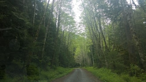
Part 3: The Humboldt National Forest

This was one of those pieces of road that put a smile on my face. Right after Ely, the road towards the Great Basin National Park goes through this forest. The forest exists on a set of hills. There is a road through these hills. This road is amazing.

Part 4: Great Basin National Park

If you go to Las Vegas and do not go to this national park then you are missing out. –CeG <oBelIX>

A sealed packet of Cheetos can explode if you change elevation fast enough. –CeG <oBelIX>

There was a volcano in the middle of what is now Nevada. This volcano, which is now known as Wheeler’s Peak stands 10,000 feet in the middle of the desert. While this in itself is not very large (re: Everest) it is tall enough to completely alter the geography of the surrounding areas. Great Basin National Park, a national park that had very few visitors so close to the Labour Day weekend. There are two primary attractions:

  • Lehman Caves
  • A 12 mile scenic drive up to Wheeler Peak

I did not do the caves (see above: I was late). I did drive up to Wheeler Peak. It is a 12 mile one-way drive and took about 20-30 minutes. I was going at a sensible pace, nothing like Hurricane Ridge, mostly because the road is untrustworthy. It is neither well banked nor smooth. There is no shoulder, there are just a few shrubs, a very pretty green, between you and a very airbag-explosion-inducing-mountain-side-should-you-go-over. The views are decent, not epic. The interesting thing to keep an eye out for is the change in flora. At the desert floor it is all sagebrush. As I went higher, it gave way to plants that required more water. Trees. Really verdant trees. It was remarkable. The exhibit at the visitor center mentioned that every thousand feet in elevation provides the same vegetation as a 600 mile increase in distance towards the pole (goop: horrible, I need a word for that).

I had a grandstand view at lunchtime!

Part 5: An unforgettable drive

The road from GBNP back to US-93 is, umm, empty. It is also banked very well. It also has nice sweeping curves. It allows you many moments of pure exhilaration. These moments are derived simply from the drive, the scenery, while not bad is not remarkable in any way.

US-93 on the other hand, after Majors and till Pioche, is a beautiful drive. The open space in the desert makes me nervous. Wary is the right word. I do not feel that way driving through the greenery in the Pacific Northwest. The desert commands respect because it is so open and so vast and because it shows you its vastness. The last time I drove through Nevada and Arizona I did not feel this. I presume it was because I had the company of three other gentlemen. This time, alone, with a narrator that was talking about Emmanuel Kant and his Critique of Pure Reason I was very aware.

At some point, I noticed a thunderstorm on the horizon, due south. US-93 heads due South. It is interesting to look at rain from far away, it looks like sheets of water, localized. The thunderstorm decided to plomp itself right on US-93 and unleash its full fury upon me. There was lightning and I recalled a Physics teacher telling me, you can’t get struck by lightning inside a metal shell. I do not remember why. I was relieved. The rain was, well, typhoonous? Hurricanous? It was slapping the windshield. I opened the window and put a hand outside and the force of the raindrops stung. It was a nerve-wracking twenty minutes, spent driving at 40 miles an hour. Unforgettable.

Gives a whole new meaning to the phrase, localized showers


Ominous

Part 6: Nevada 318

A great road is when you want to turn down the music and listen to the car. –CeG <oBelIX>

From US-93 till the Utah border. Just, well, drive it and you will know.

Part 7: Zion National Park

Not really. I lied. I did not go to Zion. However, at 8PM when an exit on I-15 says “Kolba Canyon, Zion National Park” and the words Scenic Drive below it there was no way I was not taking that exit. Especially since the tearing through Nevada and Utah had caused me to gain quite a bit of time. Things to note:

  • The road is red
  • I assisted a suicidal frog fulfill its desires
  • I need more practice at night time photography
  • Khatta Meetha is nicer than Cheetos

By now, I was sufficiently tired for the day. The remainder involved a drive, just getting from point A (ZNP) to point B (Page). The radar detector saved me in a town called Federnio or something like that, a sheriff sitting with the lights out. I think I drove over some very beautiful scenery on US-89 A and but it was too dark to make out what was going on.